
HAPS Vs Satellites: Which Wins For Stratospheric Coverage?
1. The Question Itself Reveals A Change in the Way We Consider the concept of coverage
For the better part of the last three decades, the debate of reaching remote or disadvantaged areas from above has been defined as a decision between ground infrastructure and satellites. The growth of high altitude platform stations has opened up an additional option that doesn't fit neatly into either category That's exactly what makes this a fascinating comparison. HAPS aren't attempting to replace satellites across the board. They're competing on specific use circumstances where operating at 20 kilometers instead of 35,000 or 500 kilometers produces significantly better results. Understanding where that advantage is legitimate and where it's not it's the whole point.
2. Lasting latency is where HAPS succeeds Deliberately
Signal travel time is determined by distance. This is where stratospheric platforms have an undisputed structural advantage over every orbital system. Geostationary satellites span 35,786 km over the equator. They produce high round-trip delays of about 600 milliseconds. These are acceptable for voice calls, with a noticeable delay, however it is not ideal for real-time applications. Low Earth orbit satellites have greatly improved this situation working at 550 – 1,200 kilometres, with latency ranging from the 20-40 millisecond range. A HAPS satellite at 20 km has latency values that are comparable the terrestrial internet. For situations where responsiveness is crucial (industrial control systems financial transactions, emergency communications direct-to-cell connectivity this isn't a small difference.
3. Satellites win on global coverage and That's All That Matters
No stratospheric technology currently available will cover the entire planet. Only one HAPS vehicle covers a local footprint, which is big in comparison to terrestrial dimensions, but limitless. To achieve global coverage, it is necessary to build several platforms scattered all over the globe, each with their own operations including energy systems, power sources, and station-keeping. Satellite constellations, especially large LEO networks, may cover the earth's surface with an overlap areas of coverage that the stratospheric network simply cannot replicate with existing vehicle numbers. For applications that require truly universal reach — maritime tracking, global messaging, and polar coverage, satellites are the only credible option at size.
4. Persistence and Resolution Favour Human Observation Satellites for the Earth Observation
When the objective is to monitor the same area continuouslysuch as tracking methane emissions within the industrial corridor, watching an erupting wildfire take place in real time, or monitoring oil pollution dispersing from a marine incident The ongoing closely-proximity aspect of a stratospheric instrument produces a quality of data that satellites struggle to meet. Satellites in low Earth orbit moves over any point on the surface for minutes at a time which is followed by revisit intervals in either days or hours, based on the size of the constellation. A HAPS vehicle, which remains in the same region for weeks will provide continuous monitoring using sensor proximity to provide superior spatial resolution. If you are looking to observe the stratospheric environment the persistence of this method is typically greater than a global reach.
5. Payload Flexibility Is an HAPS Advantage Satellites can't Easily Match
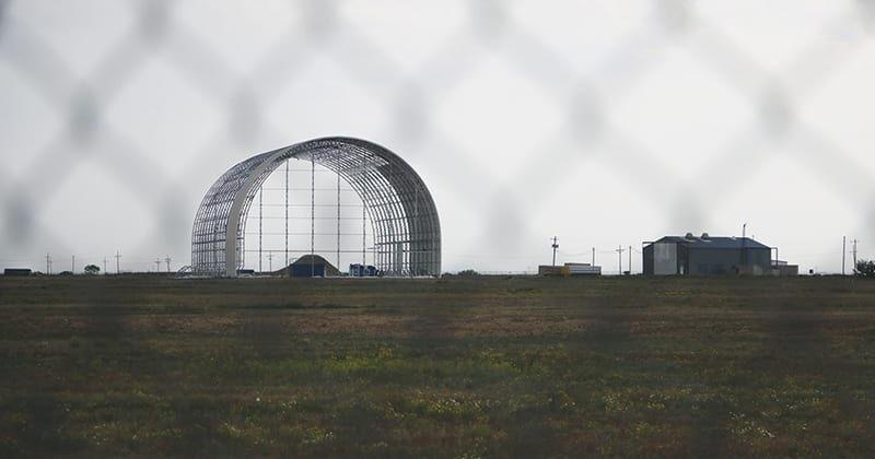
Once a satellite is set to launch, the payload fixed. Upgrading sensors, swapping communication hardware or introducing new instruments calls for the launch of an entirely new spacecraft. A stratospheric satellite returns to the ground during missions, which means its payload can be reconfigured, upgraded or completely replaced as demands for mission change or advances in technology become available. Sceye's airship design is specifically designed to accommodate significant payload capacities, which allows different combinations of antennas for telecommunications, greenhouse gas sensors as well as disaster detection systems in the same vehicle — a flexibility that requires multiple satellites to replicate, each with its own launched cost as well as orbital slots.
6. The Cost Structure Is Fundamentally Different
The launch of a satellite requires cost of the rocket such as ground segment development, insurance and the acceptance that hardware malfunctions in orbit are permanent write-offs. Stratospheric platforms operate much like aircraft – they can be recovered, examined then repaired and re-deployed. This doesn't make them less expensive than satellites on a basis of coverage area, but it changes the risk profile and their upgrade cost significantly. For those trying new services and entering markets, being able to retrieve and modify the platform just accepting it as an sunk cost provides a significant operational advantage and is particularly relevant in the early commercial phases that HAPS segment is navigating.
7. HAPS Can Act as 5G Backhaul Where Satellites Don't Effectively
The telecommunications platform enabled by the high-altitude platform station that operates as a HIBS (which is effectively an actual cell tower in the sky — is designed to interact with current technologies for wireless networks, in ways satellite communication traditionally didn't. Beamforming from a spheric telecom antenna enables dynamic signal distribution throughout a coverage region that supports 5G backhaul to ground infrastructure and direct-to-device connections simultaneously. Satellite systems are now more efficient to support this technology, but being closer to the ground affords stratospheric platforms a distinct advantage in signal intensity, frequency reuse, and compatibility with spectrum allocations that were designed for terrestrial networks.
8. Risks to Operational Safety and Weather Vary dramatically between the two
Satellites, once they have been placed in stable orbits, generally are indifferent to weather conditions on the terrestrial side. A HAPS vehicle operating in the stratosphere will face an environment that is more complicated to operate in such as stratospheric patterns of wind, temperature gradients, and the engineering challenge of making it through overnight at an altitude without losing station. The diurnal cyclic, or the daily rhythm of the solar energy availability as well as the power draw of overnight is a design restriction each solar-powered HAPS is required to work to overcome. The advancements in lithium-sulfur battery energy capacity in addition to solar cell energy efficiency have been able to close this gap, but it represents an important operational factor that satellite operators do not have to face in the exact same way.
9. The Truth is That They Serve Different Missions Best
Making HAPS and satellites appear as a competition that is winner-takes-all misses the extent to which the non-terrestrial network is likely to develop. The most accurate view is a multi-layered framework where satellites manage globally-reaching applications and where coverage universality tops all other aspects and stratospheric platforms help with regional persistence tasks -connectivity in challenging geographical environments, continuous environmental monitoring in disaster recovery, and expanding 5G to areas in which terrestrial rollout is not economically feasible. The location of Sceye's platform reflects precisely this premise: a platform specifically designed to operate in the specific area for longer periods of time, and with sensors and communications that satellites don't have the capacity to replicate at the same altitude or close proximity.
10. The Competition will eventually sharpen Both Technologies
There's a good argument that the rise of credible HAPS programmes has accelerated innovations in satellites, as well as the reverse is also true. LEO constellation operators have increased latency and coverage density in ways that increase the standard HAPS must clear to compete. HAPS developers have shown persistent regional monitoring capabilities that is prompting satellite operators examine the frequency of revisit and resolution for sensors. Sceye's Sceye and SoftBank collaboration targeting Japan's national HAPS network, with commercial services planned for 2026 is among the most clear evidences to date that stratospheric platforms are evolving from a theoretical competitor into an active participant in shaping how the non-terrestrial technology of connectivity and observation markets develops. Both technologies are more suitable in the face of pressure. View the top Sceye endurance for site tips including marawid, sceye haps airship status 2025 2026 softbank, sceye careers, what is a haps, softbank haps pre-commercial services japan 2026, Sceye endurance, sceye haps airship status 2025 2026, Diurnal flight explained, investment in future tecnologies, 5G backhaul solutions and more.
How Stratospheric Platforms Shape Earth Observation
1. Earth Observation has always been constrained by the Observer's Position
Every step in the human race's ability to observe the earth's surface was based on locating the best vantage point. Ground stations gave local precision but with no reach. Aircraft increased range, but also consumed the fuel they used and also required crews. Satellites offered global coverage, however they also introduced distance that weighed quality and revisit frequency against the scale. Each step higher in altitude helped solve some problems, while creating some others. The trade-offs inherent in each method has shaped our perceptions about our planet. However, more important, what we aren't able to clearly take action on. Stratospheric platforms give us a view which is located between aircraft and satellites in ways that can resolve some of the more persistent choices, instead of simply shifting them.
2. Persistence is the Observation Capability It Changes Everything
The most transformational thing the stratospheric platforms can provide for earth observation, is not the resolution of it; nor size of coverage, nor sensor sophistication — it is persistence. The ability to follow the same place over a long period of time, for days or weeks in a row, without gaps in the records of data, can alter the kind of questions which earth observation could answer. Satellites can answer questions regarding state: what does the location look like at this moment? The stratospheric platform that is persistent answers questions about the process- what's happening in this particular situation and how quickly is it influenced by what elements and when will intervention become necessary? For greenhouse gas monitoring, flood progression, wildfires and the spread of pollutants along the coastline processing questions are the ones that affect decision-making as they require continuity that only observation over time can provide.
3. It is believed that the Altitude Sweet Spot Produces Resolution That Satellites Do Not Match at Scale
Physics determines the relationship among an altitude, a sensor aperture and resolution of the ground. A camera operating at 20km can achieve ground resolution figures that require a large aperture to replicate from a low Earth orbit. This means that a stratospheric observation platform is able to distinguish distinct infrastructure components like pipes, tanks for storage farm plots, ships on the coast — that appear as sub-pixel blurs in satellite imagery, at similar cost to sensors. For instance, monitoring oil pollution originating from an offshore plant and determining the precise location of methane leaks that occur along the route of pipelines or observing the leading edge of a forest fire over vast terrains, this resolution benefits directly affects the specificity of information that is available to operators and decision-makers.
4. Real-time Methane Monitoring is Operationally Effective From the Stratosphere
Monitoring satellites for methane has significantly improved in recent years but the combination revisit frequency and resolution limitations implies that satellite-based detection of methane tends to pinpoint large, continuous emission sources instead of sporadic releases from certain sources. A stratospheric technology that allows live methane surveillance over an oil and gas-producing area, an agricultural zone, or a waste management corridor, alters this dynamic. Monitoring continuously at the stratospheric scale can identify emission events as they occur. They can attribute them to certain sources with a level of accuracy that satellite data can't routinely offer, and provide the kind of time-stamped precise evidence for each source that regulatory enforcement and voluntary emissions reduction programmes need to work efficiently.
5. Sceye's Approach Combines Observation With the Broader Mission Architecture
What distinguishes Sceye's way of doing stratospheric geospheric earth observation versus using it as a separate sensor deployment is the integration of observation capabilities in a larger multi-mission system. The same car that has greenhouse gas sensors, also houses connectivity hardware, disaster detection systems, and, possibly, other environmental monitoring payloads. This integration isn't simply a cost-sharing program, but represents a consistent understanding that the data streams from various sensors will be more valuable when they are in conjunction rather than on their own. A connectivity platform that monitors the environment is more beneficial to operators. A platform for observation that offers emergency communications is more advantageous to governments. Multi-mission systems increase the utility of a single stratospheric system in ways separate, single-purpose vehicles cannot replicate.
6. Oil Pollution Monitoring illustrates the operational benefits of close Proximity
Monitoring oil spills in coastal and offshore conditions is a sector where stratospheric monitoring has distinct advantages over satellite and aircraft approaches. Satellites can spot large slicks but struggle with the precision required to determine moving patterns, shoreline connections as well as the nature of smaller releases which precede larger ones. Aircrafts are able achieve the needed resolution, but they are unable to maintain continuous coverage over large areas without costly operational expense. A stratospheric based platform that is held on the coast is able to trace pollution events from their initial detectability through spreading impacts on the shoreline and eventually dispersal — giving the continuous temporal and spatial information that emergency intervention and legal accountability require. The ability to monitor pollution from oil across a wide observation time frame without gaps is an impossible feat for any other platform type for the same cost.
7. Wildfires Observation from the Stratosphere Captures what ground teams cannot see
The perspective that stratospheric high altitude offers over a wildfire in active phase is different from that accessible at ground level or from aircrafts that fly low. Complex terrain and fire behaviour is visible from afar. the front of fire, the crown fire development, and the interaction of fire with pattern of winds and fuel humidity gradients is visible in its full spatio-temporal context only from a certain altitude. The stratospheric platforms that monitor active fires provides incident commanders with real-time, broad-range view of fire activity which allows the deployment of resources according to what the fire is actually doing instead of what the ground teams in particular locations are experiencing. Notifying climate disasters in live time from this location does more than just enhance responseit improves the effectiveness of commander decisions over the course of the course of an event.
8. The Data Continuity Advantage Compounds Over the course of time
Individual observations have value. Continuous observation records have a compounding value that increases non-linearly with duration. A week of stratospheric earth observation data across an agricultural zone establishes the baseline. The month of the month shows seasonal patterns. A full year is a record of the year's cycle of development and water usage soil condition, as well as the variations in yield. Recordings over multiple years provide the basis to understand what the regional landscape is changing as a result of climate change as well as land management practices as well as trends in the availability of water. When it comes to natural resource management like agriculture, forestry or water catchment zone management, and more — this accumulated observation record is often more valuable than any observation event on its own, regardless of resolution, or the speed at which it's delivered.
9. The technology that can enable Long Observation mission is evolving rapidly.
Stratospheric observations of the earth are only as good as the platform's ability to remain in the station long enough to yield accurate data records. The energy systems governing endurance – solar cell efficiency on stratospheric planes, lithium-sulfur battery energy density that is approaching 425 Wh/kg. The closed power loop which sustains all systems through the diurnal cycle — have been improving at a speed that is increasing the likelihood of multi-week and lengthy stratospheric trips operationally viable instead of aspirationally scheduled. Sceye's work that is being conducted in New Mexico, focused on verifying these systems under real-world operational conditions, rather than lab projections, is the kind and level of engineering innovation that is directly translating into longer observation times and reliable data records of the applications that rely on them.
10. Stratospheric Platforms are Creating a New Layer of Environmental Reputability
Perhaps the most impactful long-term impact of the mature stratospheric Earth observation capabilities is what it brings to the information about environmental compliance and sustainable management of natural resources. If continuous, high-resolution surveillance of changes in land use, water extraction, and pollutant events is available constantly rather than intermittently, the accountability landscape changes. Agriculture, industrial companies as well as governments and companies engaged in extraction of natural resources all behave differently when they recognize that what they are doing is constantly monitored from above with data that is specific enough that it is legally significant and accurate enough to prompt regulatory response before damage becomes irreparable. Sceye's stratospheric platforms and the larger category of high-altitude platform stations pursuing similar observation mission, are building the infrastructure for a world where environmental accountability can be found in continuous observation, not regular self-reporting, a shift that's extending well beyond the aerospace industry that makes it possible. Check out the top rated softbank investment sceye for more examples including solar cell efficiency advancements for haps or stratospheric aircraft, sceye new mexico, Stratospheric infrastructure, softbank group satellite communication investments, Sceye endurance, softbank investment in sceye, sceye haps status 2025 2026, Sceye Softbank, Direct-to-cell, Cell tower in the sky and more.
